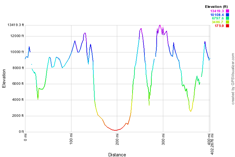
I was able to use the SPOT data to and with the help of GPSVisualizer.com create this nifty graph. Using the lat/long, it adds the elevation imported from a DEM (digital elevation model) database. So for our 400 mile trip (horizontal axis), we can get the approx elevation. Tasty photo op galore thanks to those many elevation changes in Ecuador!
The most interesting part is that we climb nearly 13,000 feet in under 50 miles as we depart Quevedo (Day 4), just to fall off it and climb again.
The most interesting part is that we climb nearly 13,000 feet in under 50 miles as we depart Quevedo (Day 4), just to fall off it and climb again.
Here's the SPOT Adventure page showing some topography.
My only minor nit I regret was the tool situation. Next time we do a self-guided tour, I think we'll just bring it down our own kit. Since you are allowed 2 bags checked and 2 bags carry on for the international flights, there is no real reason not bring stuff you are familiar with.
Looking at next years date to see when we can go back down again!
Looking at next years date to see when we can go back down again!